Based on data in OpenStreetMap, here is a list of townlands in the Electoral Division / ED / District Electoral Division of Creegh.
Creegh is in Co.
Creegh is not matched up to Logainm.ie yet.
Léarscáil
It is located at 52° 45' 6" N, 9° 23' 48" W.
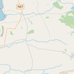


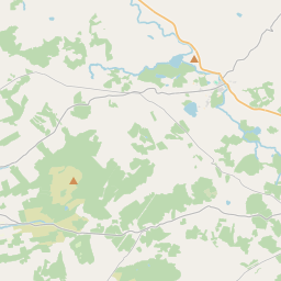
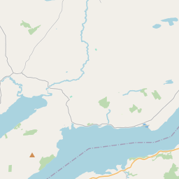
Leaflet | Map data © OpenStreetMap contributors
Achar
Creegh has an area of 20.4 km² / 5,043.2 acres / 7.9 square miles.
Ceannbhailte
There are 11 townlands that we know about in . This represents 100% of all the area in .
- Caheraghacullin 252 A, 1 R, 4 P
- An Clochán Beag Thoir 468 A, 1 R, 4 P
- An Clochán Beag Thiar 232 A, 2 R, 25 P
- An Clochán Mór Thoir 587 A, 1 R, 22 P
- An Clochán Mór Thiar 560 A, 1 R, 36 P
- Cluain Fhíne 305 A, 2 R, 12 P
- Cloonwhite North 257 A, 2 R, 4 P
- Cloonwhite South 269 A, 2 R, 13 P
- Creegh North 639 A, 3 R, 2 P
- Creegh South 487 A, 0 R, 24 P
- Liatroim 982 A, 1 R, 39 P
 OpenStreetMap
Creegh was added to OpenStreetMap on 15 Noll 2016 by Teester.
- View
- Edit