Based on data in OpenStreetMap, here is a list of townlands in the Electoral Division / ED / District Electoral Division of Mullagh.
Mullagh is in Co.
Mullagh is not matched up to Logainm.ie yet.
Léarscáil
It is located at 52° 47' 15" N, 9° 22' 43" W.
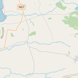


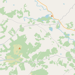
Leaflet | Map data © OpenStreetMap contributors
Achar
Mullagh has an area of 16.8 km² / 4,156.4 acres / 6.5 square miles.
Ceannbhailte
There are 11 townlands that we know about in . This represents 100% of all the area in .
- Ceathrú an Logáin 407 A, 0 R, 33 P
- Carrownaghy South 293 A, 3 R, 16 P
- Carrownagry North 357 A, 2 R, 31 P
- Clochán na Tine 272 A, 0 R, 34 P
- An Doirín 216 A, 3 R, 2 P
- Dún Ógáin 1050 A, 1 R, 9 P
- Knocknahila Beg 321 A, 0 R, 8 P
- Knocknahila More (North) 334 A, 3 R, 17 P
- Knocknahila More (South) 438 A, 1 R, 25 P
- Maigh Ghlas Bheag 200 A, 1 R, 1 P
- Maigh Ghlas Mhór 263 A, 3 R, 3 P
 OpenStreetMap
Mullagh was added to OpenStreetMap on 15 Noll 2016 by Teester.
- View
- Edit