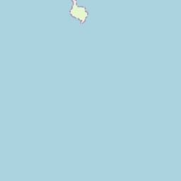
Based on data in OpenStreetMap, here is a list of townlands in the Electoral Division / ED / District Electoral Division of Butlerstown.
Butlerstown is in Co.
Butlerstown is not matched up to Logainm.ie yet.
Léarscáil
It is located at 51° 35' 46" N, 8° 43' 54" W.
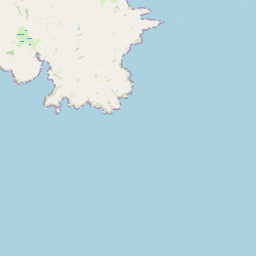
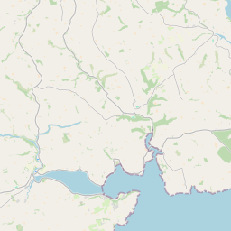
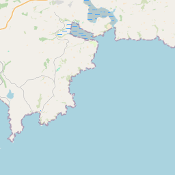

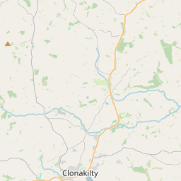


Leaflet | Map data © OpenStreetMap contributors
Achar
Butlerstown has an area of 17.7 km² / 4,372.3 acres / 6.8 square miles.
Ceannbhailte
There are 19 townlands that we know about in . This represents 99.0% of all the area in .
- Ard an Chócaigh 108 A, 3 R, 3 P
- Baile an Cholpa 96 A, 1 R, 23 P
- Baile an Lúigh 185 A, 1 R, 1 P
- Baile an Bhrócaigh 245 A, 1 R, 15 P
- Baile Chairdín 62 A, 2 R, 14 P
- Baile Thaidhgín 56 A, 1 R, 9 P
- Baile Hoiste 57 A, 2 R, 24 P
- Baile an Longaigh 192 A, 3 R, 13 P
- Baile Mhic Réamainn 539 A, 1 R, 28 P
- Baile Mhic Sheoinín 239 A, 2 R, 1 P
- Baile na Móna 236 A, 2 R, 28 P
- Baile an Bhuitléaraigh 366 A, 1 R, 8 P
- An Carraigín 247 A, 3 R, 8 P
- An Curraichín 237 A, 0 R, 34 P
- Dún Urlainn 340 A, 2 R, 16 P
- Kilsillagh 244 A, 2 R, 21 P
- Lios Uí Chroimín 506 A, 3 R, 19 P
- Seanach an Bharraigh Bháin 194 A, 1 R, 7 P
- Ternanean 170 A, 3 R, 25 P
 OpenStreetMap
Butlerstown was added to OpenStreetMap on 20 Ean 2017 by Teester.
- View
- Edit