Based on data in OpenStreetMap, here is a list of townlands in the Electoral Division / ED / District Electoral Division of Castlehaven South.
Castlehaven South is in Co.
Castlehaven South is not matched up to Logainm.ie yet.
Léarscáil
It is located at 51° 30' 15" N, 9° 15' 14" W.
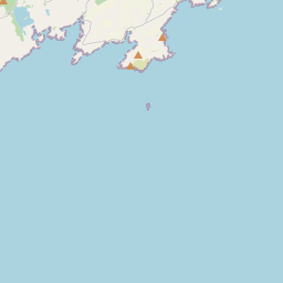

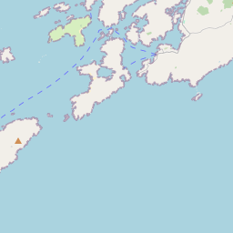


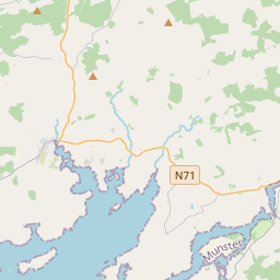
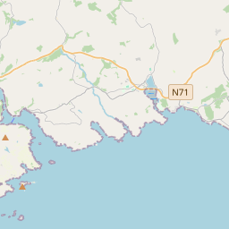


Leaflet | Map data © OpenStreetMap contributors
Achar
Castlehaven South has an area of 19.0 km² / 4,694.1 acres / 7.3 square miles.
Ceannbhailte
There are 28 townlands that we know about in . This represents 95.0% of all the area in .
- Ard an Ghiolla 73 A, 0 R, 0 P
- Ard Gaotháin 184 A, 3 R, 37 P
- Baile Uí Áille 198 A, 2 R, 20 P
- Baile an Oileáin 107 A, 0 R, 25 P
- An Baile Uachtarach 156 A, 2 R, 16 P
- Barraí Rua 235 A, 2 R, 32 P
- An Bán íseal 384 A, 1 R, 24 P
- An Bán Leathan 185 A, 1 R, 7 P
- An Bhuaile Bhán 97 A, 3 R, 35 P
- Bullock Island 17 A, 0 R, 27 P
- An Chrois Liath 41 A, 3 R, 36 P
- An Corrbhaile 106 A, 0 R, 21 P
- An Dúinín 272 A, 0 R, 0 P
- An Driseán Beag 336 A, 2 R, 19 P
- Drishane Island 0 A, 3 R, 7 P
- An Driseán Mór 310 A, 1 R, 27 P
- Drumadoon 139 A, 3 R, 32 P
- Fearann Uí Chonchúir 119 A, 0 R, 18 P
- Gleann an Gheimhil 110 A, 2 R, 26 P
- Geocán 190 A, 3 R, 1 P
- Gort an Chrosaigh 217 A, 1 R, 8 P
- Goirtín an Lomáin 189 A, 3 R, 20 P
- An Leathardán Mór 231 A, 2 R, 11 P
- Leathfhearann an Tí 121 A, 1 R, 10 P
- Leic Eoghain 139 A, 3 R, 18 P
- Rinn Dá Chosán 99 A, 3 R, 33 P
- An Scoth Bhán 188 A, 2 R, 34 P
- The Stags 1 A, 2 R, 34 P
 OpenStreetMap
Castlehaven South was added to OpenStreetMap on 14 Ean 2017 by Teester.
- View
- Edit