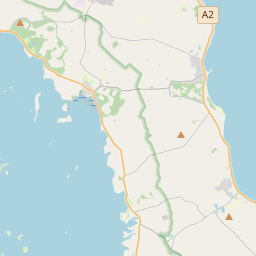
Based on data in OpenStreetMap, here is a list of townlands in the Electoral Division / ED / District Electoral Division of Ardkeen.
Ardkeen is in Co.
Ardkeen is not matched up to Logainm.ie yet.
Léarscáil
It is located at 54° 26' 17" N, 5° 30' 3" W.


Leaflet | Map data © OpenStreetMap contributors
Achar
Ardkeen has an area of 21.7 km² / 5,351.8 acres / 8.4 square miles.
Ceannbhailte
There are 17 townlands that we know about in . This represents 100% of all the area in .
- Ard Caoin 545 A, 1 R, 3 P
- Baile Crannaí Beag 381 A, 0 R, 33 P
- Baile Gaelach 632 A, 1 R, 13 P
- Baile Bhaird 274 A, 0 R, 11 P
- Broom Quarter 67 A, 1 R, 26 P
- An Caisleán Buí 152 A, 0 R, 20 P
- Clochaigh 232 A, 2 R, 29 P
- Baile Chócaire 305 A, 3 R, 4 P
- Druim Ardáin 163 A, 3 R, 21 P
- Druim Ardáin 51 A, 3 R, 7 P
- Dún Eichmhílidh 264 A, 2 R, 24 P
- Baile Chirc 1073 A, 1 R, 6 P
- An Lios Bán 264 A, 2 R, 12 P
- Loch Dubh 172 A, 0 R, 38 P
- Ráth tSaileach 357 A, 3 R, 35 P
- Tulaigh na Croise 147 A, 3 R, 15 P
- Tulaigh Thromáin 264 A, 2 R, 22 P
 OpenStreetMap
Ardkeen was added to OpenStreetMap on 19 Feabh 2021 by b-unicycling.
- View
- Edit

 JOSM
JOSM iD
iD