Based on data in OpenStreetMap, here is a list of townlands in the Electoral Division / ED / District Electoral Division of Maze.
Maze is in Co.
Maze is not matched up to Logainm.ie yet.
Léarscáil
It is located at 54° 28' 46" N, 6° 5' 25" W.
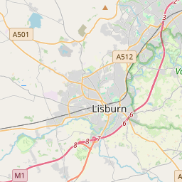
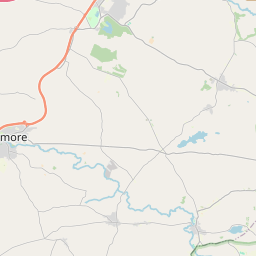

Leaflet | Map data © OpenStreetMap contributors
Achar
Maze has an area of 20.9 km² / 5,169.4 acres / 8.1 square miles.
Ceannbhailte
There are 12 townlands that we know about in . This represents 100% of all the area in .
- Achadh na Triosca 252 A, 0 R, 4 P
- Áth na Cloiche 192 A, 0 R, 8 P
- An Baile Caol Éadan Ó gConaill 234 A, 0 R, 34 P
- An Carn Bán 527 A, 1 R, 18 P
- An Carn Riabhach 408 A, 3 R, 37 P
- Cúil Chéibhe 795 A, 3 R, 8 P
- Dromainn Tí Aodha 252 A, 3 R, 15 P
- Dromainn Tí Aodha 35 A, 0 R, 35 P
- Machaire na gCaorach 432 A, 2 R, 12 P
- Maze 1557 A, 3 R, 21 P
- Ráth Bhearnáin 404 A, 3 R, 37 P
- Reillys Trench 75 A, 1 R, 32 P
 OpenStreetMap
Maze was added to OpenStreetMap on 20 Feabh 2021 by b-unicycling.
- View
- Edit