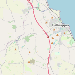
Based on data in OpenStreetMap, here is a list of townlands in the Electoral Division / ED / District Electoral Division of Donabate.
Donabate is in Co.
Donabate is not matched up to Logainm.ie yet.
Léarscáil
It is located at 53° 29' 1" N, 6° 8' 19" W.


Leaflet | Map data © OpenStreetMap contributors
Achar
Donabate has an area of 25.1 km² / 6,214.4 acres / 9.7 square miles.
Ceannbhailte
There are 19 townlands that we know about in . This represents 76.3% of all the area in .
- Baile Carraige 210 A, 3 R, 29 P
- Baile Eilís Thuaidh 65 A, 3 R, 10 P
- Baile Eilís Theas 9 A, 2 R, 38 P
- Baile Eilís Thiar 37 A, 0 R, 5 P
- Baile Uisce 41 A, 1 R, 0 P
- Coimin Bhaile Uisce 91 A, 3 R, 9 P
- Baile Mastún 120 A, 1 R, 13 P
- Baile an Bhéibhéaraigh 426 A, 2 R, 38 P
- An Coinicéar 307 A, 0 R, 2 P
- An Corrbhaile 984 A, 1 R, 13 P
- Domhnach Bat 81 A, 3 R, 8 P
- Cill Chreach 397 A, 2 R, 23 P
- Baile an Lóndaigh 504 A, 2 R, 29 P
- Diméin an Droichid Nua 353 A, 3 R, 30 P
- Port Reachrann 106 A, 2 R, 23 P
- Diméin Phort Reachrann 472 A, 3 R, 38 P
- An Ché 67 A, 0 R, 10 P
- Ráth Chuilinn 134 A, 3 R, 17 P
- Tuirbhe 325 A, 2 R, 2 P
 OpenStreetMap
Donabate was added to OpenStreetMap on 28 Lún 2015 by brianh.
- View
- Edit

 JOSM
JOSM iD
iD