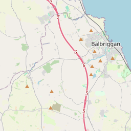
Based on data in OpenStreetMap, here is a list of townlands in the Electoral Division / ED / District Electoral Division of Swords West.
Swords West is in Co.
Swords West is not matched up to Logainm.ie yet.
Léarscáil
It is located at 53° 28' 31" N, 6° 14' 40" W.


Leaflet | Map data © OpenStreetMap contributors
Achar
Swords West has an area of 31.1 km² / 7,695.4 acres / 12.0 square miles.
Ceannbhailte
There are 36 townlands that we know about in . This represents 100% of all the area in .
- Baile Deargáin 247 A, 1 R, 27 P
- Baile Anraí 405 A, 0 R, 5 P
- Diméin Bhaile Anraí 191 A, 3 R, 1 P
- Baile Bhéilinn 464 A, 2 R, 15 P
- Baile Bhéilinn 337 A, 1 R, 2 P
- Baile Breacáin 218 A, 0 R, 38 P
- An Móinéar Leathan 211 A, 1 R, 37 P
- Baile an Bhrúnaigh 245 A, 3 R, 2 P
- Feirm an Chaisleáin 38 A, 1 R, 33 P
- An Coimín Thiar 48 A, 2 R, 27 P
- Baile an Chócaigh 163 A, 2 R, 20 P
- Cremona 13 A, 3 R, 12 P
- Baile an Déanaigh 253 A, 1 R, 8 P
- Fearann an Dullardaigh 62 A, 1 R, 3 P
- An Fhoraois Mhór 524 A, 0 R, 10 P
- An Fhoraois Bheag 256 A, 2 R, 30 P
- Baile an Fhoraistéaraigh Thuaidh 107 A, 1 R, 22 P
- Baile an Fhoraistéaraigh Theas 126 A, 2 R, 19 P
- An Ghléib 30 A, 3 R, 27 P
- An Bruach Naofa 17 A, 2 R, 20 P
- Baile an Huntaigh 204 A, 2 R, 36 P
- Baile Shéamais 41 A, 1 R, 21 P
- Cnoc Siáin 97 A, 0 R, 33 P
- Halla an Leasáin Beag 318 A, 2 R, 36 P
- Baile Mhic Giolla 328 A, 3 R, 37 P
- Baile na Móna 310 A, 1 R, 39 P
- An Baile Nua 229 A, 1 R, 34 P
- An Seanbhaile 159 A, 3 R, 38 P
- An Fearann Seachtrach 77 A, 0 R, 34 P
- Ráth Béil 594 A, 2 R, 32 P
- Ráth Aingil 113 A, 1 R, 38 P
- Baile Uí Rócháin 141 A, 3 R, 25 P
- Baile an tSásaraigh 210 A, 2 R, 1 P
- Sceach Dhubh 660 A, 2 R, 25 P
- Tóin le Gaoith 82 A, 0 R, 6 P
- Fearann an Mhuilinn Ghaoithe 158 A, 3 R, 9 P
 OpenStreetMap
Swords West was added to OpenStreetMap on 26 Márta 2021 by b-unicycling.
- View
- Edit

 JOSM
JOSM iD
iD