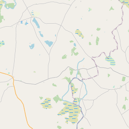
Based on data in OpenStreetMap, here is a list of townlands in the Electoral Division / ED / District Electoral Division of Kilcoona.
Kilcoona is in Co.
Kilcoona is not matched up to Logainm.ie yet.
Léarscáil
It is located at 53° 28' 27" N, 9° 1' 25" W.


Leaflet | Map data © OpenStreetMap contributors
Achar
Kilcoona has an area of 20.0 km² / 4,931.2 acres / 7.7 square miles.
Ceannbhailte
There are 16 townlands that we know about in . This represents 100% of all the area in .
- Baile Uí Cholgan 189 A, 1 R, 29 P
- An Bán Mór 100 A, 3 R, 30 P
- Bóthar Coill 315 A, 3 R, 29 P
- Cathair Loistreáin 156 A, 1 R, 8 P
- Ceathrú Uí Chonalláin 142 A, 0 R, 38 P
- An Chéibh 200 A, 3 R, 1 P
- Crois Fhursa 556 A, 0 R, 24 P
- Domhnach Pádraig 645 A, 3 R, 28 P
- Gort na Pónaire 251 A, 2 R, 32 P
- Cill Droma 193 A, 0 R, 11 P
- Cill Mhothlan 196 A, 2 R, 14 P
- Lios Donncha 258 A, 3 R, 6 P
- Maigh Leasa Fhlainn 537 A, 0 R, 14 P
- Olltóir 192 A, 2 R, 39 P
- Poll na hAille 740 A, 3 R, 32 P
- An Raithín 252 A, 2 R, 11 P
 OpenStreetMap
Kilcoona was added to OpenStreetMap on 3 Beal 2016 by Boggedy.
- View
- Edit

 JOSM
JOSM iD
iD