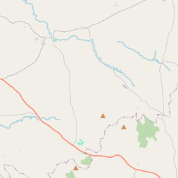
Based on data in OpenStreetMap, here is a list of townlands in the Electoral Division / ED / District Electoral Division of Shanmullagh.
Shanmullagh is in Co.
Shanmullagh is not matched up to Logainm.ie yet.
Léarscáil
It is located at 54° 22' 47" N, 7° 2' 43" W.


Leaflet | Map data © OpenStreetMap contributors
Achar
Shanmullagh has an area of 13.8 km² / 3,400.1 acres / 5.3 square miles.
Ceannbhailte
There are 24 townlands that we know about in . This represents 100% of all the area in .
- Achadh Mhic Giolla Eoin 293 A, 3 R, 31 P
- Ard Circe 62 A, 2 R, 17 P
- Cúil Bhirn 171 A, 2 R, 31 P
- An Currach Breac 166 A, 3 R, 21 P
- Corr na hÉimhe 86 A, 1 R, 19 P
- An Choraidh 54 A, 2 R, 18 P
- Doire na dTarbh 165 A, 3 R, 31 P
- Doire na Gabhla 149 A, 0 R, 0 P
- Derryellan 160 A, 1 R, 27 P
- Doire Liath Beag 105 A, 0 R, 7 P
- Doire Liath Mór 111 A, 1 R, 19 P
- Droim Leastar 119 A, 2 R, 2 P
- An tÉadan Mór 71 A, 0 R, 29 P
- An Gleann Mór 212 A, 1 R, 11 P
- An Ghréach 345 A, 3 R, 36 P
- Coill Eanaigh 148 A, 3 R, 18 P
- Coillidh Bhirn 138 A, 1 R, 23 P
- Coillidh Dhraighin 119 A, 0 R, 12 P
- Coillidh Shleamháin 99 A, 2 R, 38 P
- Lopán 124 A, 2 R, 28 P
- An Mullach Uachtarach 130 A, 1 R, 34 P
- Ráth Ceallaigh 52 A, 0 R, 9 P
- An Seanmhullach 160 A, 3 R, 4 P
- Tír Earáin 149 A, 0 R, 19 P
 OpenStreetMap
Shanmullagh was added to OpenStreetMap on 15 Márta 2021 by b-unicycling.
- View
- Edit

 JOSM
JOSM iD
iD