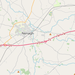
Based on data in OpenStreetMap, here is a list of townlands in the Electoral Division / ED / District Electoral Division of Uskane.
Uskane is in Co.
Uskane is not matched up to Logainm.ie yet.
Léarscáil
It is located at 53° 0' 39" N, 8° 6' 4" W.


Leaflet | Map data © OpenStreetMap contributors
Achar
Uskane has an area of 21.1 km² / 5,219.7 acres / 8.2 square miles.
Ceannbhailte
There are 20 townlands that we know about in . This represents 100% of all the area in .
- Baile Uí Chathasaigh 284 A, 2 R, 1 P
- Baile Uí Ruairc 351 A, 0 R, 18 P
- Baile Uí Spealáin Theas 192 A, 2 R, 39 P
- An Bán Mór 155 A, 3 R, 12 P
- Bun na gCúigí 59 A, 0 R, 28 P
- Ceapach na Sméar 464 A, 2 R, 1 P
- Clárchoill 231 A, 1 R, 0 P
- Comhar Éimhín 430 A, 3 R, 39 P
- Cnocán na Cúirte 167 A, 3 R, 8 P
- An Currach 128 A, 3 R, 13 P
- Doire an Bhuachalla 424 A, 1 R, 3 P
- Dromainn na Meathán 454 A, 3 R, 27 P
- Drumnamahaneisland 351 A, 3 R, 10 P
- Ime an Uisce 68 A, 1 R, 8 P
- Fia 456 A, 2 R, 13 P
- Feigh East 55 A, 0 R, 32 P
- Feigh West 48 A, 3 R, 24 P
- An Garraí Ard 321 A, 2 R, 34 P
- An Baile Láir 220 A, 2 R, 36 P
- Uisceán 350 A, 2 R, 4 P
 OpenStreetMap
Uskane was added to OpenStreetMap on 3 Noll 2016 by Teester.
- View
- Edit

 JOSM
JOSM iD
iD