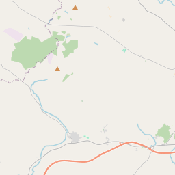
Based on data in OpenStreetMap, here is a list of townlands in the Electoral Division / ED / District Electoral Division of Altmore.
Altmore is in Co.
Altmore is not matched up to Logainm.ie yet.
Léarscáil
It is located at 54° 32' 57" N, 6° 55' 14" W.


Leaflet | Map data © OpenStreetMap contributors
Achar
Altmore has an area of 30.1 km² / 7,434.8 acres / 11.6 square miles.
Ceannbhailte
There are 19 townlands that we know about in . This represents 100% of all the area in .
- Achadh na Sgeach 244 A, 1 R, 18 P
- Alt Mor 1124 A, 0 R, 18 P
- Cam-Achadh 452 A, 3 R, 16 P
- Ceapach 409 A, 2 R, 36 P
- Cor na madadh 569 A, 0 R, 17 P
- Crannog 757 A, 2 R, 11 P
- Cros Caibdheanaigh 270 A, 0 R, 17 P
- Doire na n-Each 325 A, 0 R, 25 P
- Gall-bhaile 257 A, 3 R, 28 P
- Gleann Beag 321 A, 2 R, 19 P
- Gleann Buirrisg 185 A, 2 R, 18 P
- Gort na Gobhla 187 A, 3 R, 11 P
- Coill Mor 223 A, 3 R, 11 P
- Coill na Slighe 301 A, 2 R, 13 P
- Cnoc a Chluithche 382 A, 0 R, 4 P
- Lurga Liath 412 A, 2 R, 38 P
- Mullaghfurtherland 161 A, 1 R, 31 P
- Seiseadhach Donnchadha 420 A, 1 R, 29 P
- Sean-Mhachaire 426 A, 2 R, 33 P
 OpenStreetMap
Altmore was added to OpenStreetMap on 2 Márta 2021 by b-unicycling.
- View
- Edit

 JOSM
JOSM iD
iD