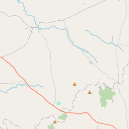
Based on data in OpenStreetMap, here is a list of townlands in the Electoral Division / ED / District Electoral Division of Cloghan.
Cloghan is in Co.
Cloghan is not matched up to Logainm.ie yet.
Léarscáil
It is located at 54° 23' 32" N, 7° 10' 9" W.


Leaflet | Map data © OpenStreetMap contributors
Achar
Cloghan has an area of 23.4 km² / 5,790.7 acres / 9.0 square miles.
Ceannbhailte
There are 23 townlands that we know about in . This represents 100% of all the area in .
- Ashfield 98 A, 1 R, 17 P
- Ashfield 994 A, 2 R, 26 P
- Ballymagowan 290 A, 0 R, 32 P
- Baile Uí Sceallaigh 420 A, 2 R, 26 P
- Carr na Tine 70 A, 1 R, 23 P
- Caraidh clochair 252 A, 2 R, 6 P
- Clogher Demesne 564 A, 0 R, 34 P
- Clochar 177 A, 3 R, 37 P
- Cloch Linne 75 A, 3 R, 23 P
- Comhrac 227 A, 3 R, 16 P
- Cor leaghan 893 A, 1 R, 9 P
- Cros Eoghain 38 A, 1 R, 24 P
- Druim Thuirc 160 A, 0 R, 31 P
- Droim Thoirc 74 A, 2 R, 2 P
- Fraoch Mór 245 A, 2 R, 7 P
- Lios Mór 117 A, 2 R, 26 P
- Lios na Machaire 183 A, 0 R, 18 P
- Mullach Tine 188 A, 0 R, 37 P
- Fhuar coise 140 A, 0 R, 13 P
- Rath Toraidhe 153 A, 0 R, 11 P
- Sean-Chuach 169 A, 0 R, 13 P
- Tir Ruadh 64 A, 0 R, 3 P
- Tulaigh Brúm 190 A, 2 R, 18 P
 OpenStreetMap
Cloghan was added to OpenStreetMap on 2 Márta 2021 by b-unicycling.
- View
- Edit

 JOSM
JOSM iD
iD