Based on data in OpenStreetMap, here is a list of townlands in the Electoral Division / ED / District Electoral Division of Killea.
Killea is in Co.
Killea is not matched up to Logainm.ie yet.
Léarscáil
It is located at 52° 10' 5" N, 7° 0' 22" W.
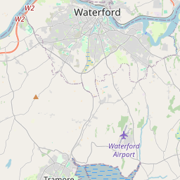
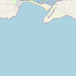
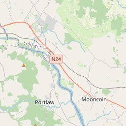

Leaflet | Map data © OpenStreetMap contributors
Achar
Killea has an area of 13.7 km² / 3,376.8 acres / 5.3 square miles.
Ceannbhailte
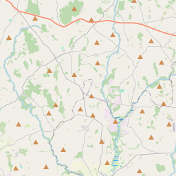
There are 15 townlands that we know about in . This represents 100% of all the area in .
- Áth Scortha Mór 39 A, 2 R, 23 P
- Áth Scortha Beag 9 A, 0 R, 5 P
- Baile Maibín 293 A, 0 R, 36 P
- An Coimín 22 A, 2 R, 1 P
- Ceann Créadáin 526 A, 0 R, 2 P
- Dún Mór 414 A, 2 R, 18 P
- Fornachta 381 A, 2 R, 5 P
- An Ghléib 16 A, 0 R, 28 P
- Cill Áthláin 65 A, 1 R, 35 P
- Killea 2 A, 2 R, 10 P
- Cill Mochuma 449 A, 3 R, 31 P
- Cnocán Uí Churraoin 38 A, 0 R, 37 P
- An Leacán 231 A, 0 R, 14 P
- Baile na Lobhar 825 A, 3 R, 31 P
- Nymphall 60 A, 3 R, 10 P
 OpenStreetMap
Killea was added to OpenStreetMap on 25 Samh 2016 by Teester.
- View
- Edit