Based on data in OpenStreetMap, here is a list of townlands in An Ros Dubh.
An Ros Dubh is in the baronies of An Ghailltír.
An Ros Dubh is in the counties of Contae Phort Láirge.
An Ros Dubh is on Logainm.ie: An Ros Dubh.
Léarscáil
It is located at 52° 11' 53" N, 7° 0' 59" W.
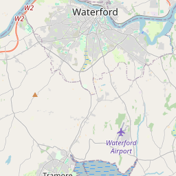
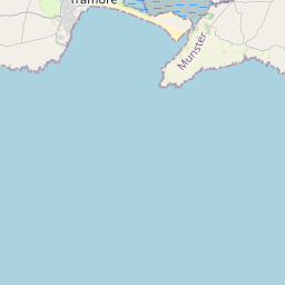
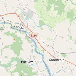

Leaflet | Map data © OpenStreetMap contributors
Achar
An Ros Dubh has an area of 0.8 km² / 197.7 acres / 0.3 square miles.
Ceannbhailte
There are 1 townland that we know about in An Ros Dubh. This represents 100% of all the area in An Ros Dubh.
- An Ros Dubh (An Ros Dubh) , An Ros Dubh Paróiste Sibhialta, Barúntacht An Ghailltír, Co. Contae Phort Láirge 197 A, 2 R, 38 P
- An Ros Dubh (see An Ros Dubh (An Ros Dubh) , An Ros Dubh Paróiste Sibhialta, Barúntacht An Ghailltír, Co. Contae Phort Láirge)
 OpenStreetMap
An Ros Dubh was added to OpenStreetMap on 26 Iúil 2016 by Teester.
- View
- Edit