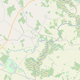
Based on data in OpenStreetMap, here is a list of townlands in the Electoral Division / ED / District Electoral Division of Skeagh.
Skeagh is in Co.
Skeagh is not matched up to Logainm.ie yet.
Léarscáil
It is located at 53° 32' 39" N, 7° 34' 13" W.


Leaflet | Map data © OpenStreetMap contributors
Achar
Skeagh has an area of 17.5 km² / 4,318.4 acres / 6.7 square miles.
Ceannbhailte
There are 19 townlands that we know about in . This represents 100% of all the area in .
- Ballard 204 A, 2 R, 27 P
- Balrath 217 A, 3 R, 2 P
- Bigfurze 114 A, 2 R, 15 P
- Cleggarnagh 53 A, 2 R, 3 P
- Clonymurtagh 54 A, 1 R, 38 P
- Corkan 352 A, 3 R, 38 P
- Curraghboy 264 A, 3 R, 23 P
- Irishtown 767 A, 0 R, 26 P
- Kilgawny 535 A, 2 R, 8 P
- Lisnacask 167 A, 2 R, 0 P
- Luggygalla 82 A, 1 R, 10 P
- Modranstown 122 A, 1 R, 2 P
- An Gníomh Briste Thuaidh 125 A, 2 R, 31 P
- Pishanagh 72 A, 2 R, 27 P
- Rathcastle 147 A, 3 R, 18 P
- Rathduff 298 A, 0 R, 0 P
- Rowlandstown 291 A, 1 R, 0 P
- An Sceach Bheag 52 A, 0 R, 36 P
- An Sceach Mhór 392 A, 3 R, 24 P
 OpenStreetMap
Skeagh was added to OpenStreetMap on 6 Feabh 2017 by Teester.
- View
- Edit

 JOSM
JOSM iD
iD