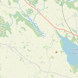
Based on data in OpenStreetMap, here is a list of townlands in the Electoral Division / ED / District Electoral Division of Street.
Street is in Co.
Street is not matched up to Logainm.ie yet.
Léarscáil
It is located at 53° 40' 48" N, 7° 28' 0" W.


Leaflet | Map data © OpenStreetMap contributors
Achar
Street has an area of 31.0 km² / 7,660.2 acres / 12.0 square miles.
Ceannbhailte
There are 19 townlands that we know about in . This represents 100% of all the area in .
- Ballykildevin 103 A, 1 R, 35 P
- Barradrum 420 A, 3 R, 36 P
- Bottomy 806 A, 0 R, 16 P
- Burgesland 138 A, 0 R, 8 P
- Clonconnell 193 A, 0 R, 38 P
- Clonkeen 646 A, 1 R, 30 P
- Cúil na gCon 970 A, 0 R, 33 P
- Cornacausk 338 A, 2 R, 33 P
- Correaly 619 A, 0 R, 37 P
- Culvin 387 A, 1 R, 32 P
- Derradd 284 A, 2 R, 15 P
- Dunamon 181 A, 2 R, 37 P
- Fearmore 309 A, 1 R, 3 P
- Garriskil 441 A, 2 R, 21 P
- Gortanear 216 A, 3 R, 14 P
- Hospitalbank 66 A, 2 R, 29 P
- Kilmore 631 A, 3 R, 11 P
- Monagead 162 A, 2 R, 27 P
- Tinode 741 A, 0 R, 11 P
 OpenStreetMap
Street was added to OpenStreetMap on 7 Feabh 2017 by Teester.
- View
- Edit

 JOSM
JOSM iD
iD