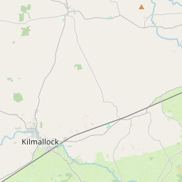
Based on data in OpenStreetMap, here is a list of townlands in the Electoral Division / ED / District Electoral Division of Kilmallock.
Kilmallock is in Co.
Kilmallock is not matched up to Logainm.ie yet.
Map
It is located at 52° 23' 56" N, 8° 34' 12" W.


Leaflet | Map data © OpenStreetMap contributors
Area
Kilmallock has an area of 22.3 km² / 5,510.6 acres / 8.6 square miles.
Townlands
There are 32 townlands that we know about in . This represents 100% of all the area in .
- Abbeyfarm 55 A, 2 R, 16 P
- Ardkilmartin 407 A, 2 R, 19 P
- Ardyoul 66 A, 0 R, 28 P
- Ash Hill 257 A, 0 R, 29 P
- Ballingaddy North 362 A, 3 R, 9 P
- Ballingaddy South 128 A, 2 R, 6 P
- Ballycullane 297 A, 1 R, 38 P
- Bawntard North 210 A, 3 R, 15 P
- Bawntard South 138 A, 3 R, 7 P
- Breesheen North 117 A, 2 R, 29 P
- Breesheen South 192 A, 3 R, 9 P
- Coolroe 114 A, 2 R, 13 P
- Cullamus 87 A, 0 R, 27 P
- Deebert 129 A, 3 R, 35 P
- Fairyfield Glebe 55 A, 0 R, 32 P
- Garrynoe 110 A, 1 R, 12 P
- Glenfield 427 A, 1 R, 19 P
- Gortboy 162 A, 1 R, 32 P
- Gotoon 83 A, 3 R, 26 P
- Graiganster 191 A, 3 R, 12 P
- Graiganster 89 A, 0 R, 20 P
- Kilmallock 31 A, 0 R, 39 P
- Kilmallock Hill 30 A, 1 R, 28 P
- Millmount 219 A, 3 R, 10 P
- Milltown 56 A, 2 R, 17 P
- Mountcoote 336 A, 3 R, 34 P
- Mountfoy 284 A, 3 R, 13 P
- Portauns 358 A, 1 R, 38 P
- Proonts 26 A, 2 R, 20 P
- Riversfield 164 A, 0 R, 18 P
- Steales 142 A, 2 R, 36 P
- Treanlewis 171 A, 0 R, 34 P
 OpenStreetMap
Kilmallock was added to OpenStreetMap on 21 Dec 2016 by Teester.
- View
- Edit

 JOSM
JOSM iD
iD