Based on data in OpenStreetMap, here is a list of townlands in the Electoral Division / ED / District Electoral Division of Newcastle Rural.
Newcastle Rural is in Co.
Newcastle Rural is not matched up to Logainm.ie yet.
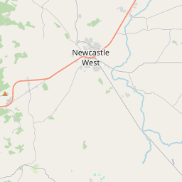
Map
It is located at 52° 26' 54" N, 9° 3' 37" W.


Leaflet | Map data © OpenStreetMap contributors
Area
Newcastle Rural has an area of 26.0 km² / 6,428.6 acres / 10.0 square miles.
Townlands
There are 23 townlands that we know about in . This represents 85.0% of all the area in .
- Ardnacrohy 241 A, 2 R, 8 P
- Ballingowan 219 A, 2 R, 9 P
- Ballintubbrid 371 A, 2 R, 12 P
- Ballinvallig 85 A, 2 R, 3 P
- Ballinvullin 382 A, 2 R, 6 P
- Ballycluvane 132 A, 1 R, 38 P
- Ballylahiff 145 A, 2 R, 5 P
- Ballyquirk 261 A, 2 R, 9 P
- Cloonyscrehane 264 A, 3 R, 31 P
- Dooally 399 A, 3 R, 28 P
- Dromin 416 A, 3 R, 35 P
- Dromin (Beesom) 240 A, 1 R, 6 P
- Dromin (Macturlogh) 428 A, 3 R, 15 P
- Dungeeha 304 A, 2 R, 17 P
- Garranekeevan 180 A, 0 R, 3 P
- Gortroe 176 A, 2 R, 31 P
- Gortyknaveen 70 A, 2 R, 22 P
- Killeline 175 A, 0 R, 18 P
- Kilrodane 304 A, 2 R, 2 P
- Moveedy 120 A, 3 R, 3 P
- Shangarry 183 A, 0 R, 14 P
- Teermena 232 A, 1 R, 32 P
- Treanboy 123 A, 2 R, 31 P
 OpenStreetMap
Newcastle Rural was added to OpenStreetMap on 6 Jan 2017 by Teester.
- View
- Edit

 JOSM
JOSM iD
iD