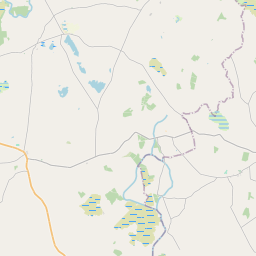
Based on data in OpenStreetMap, here is a list of townlands in the Electoral Division / ED / District Electoral Division of Kilcommon.
Kilcommon is in Co.
Kilcommon is not matched up to Logainm.ie yet.
Map
It is located at 53° 36' 53" N, 9° 3' 23" W.


Leaflet | Map data © OpenStreetMap contributors
Area
Kilcommon has an area of 39.7 km² / 9,803.3 acres / 15.3 square miles.
Townlands
There are 36 townlands that we know about in . This represents 100% of all the area in .
- Annefield 478 A, 3 R, 37 P
- Ballyheeragh (Caslane) 302 A, 0 R, 10 P
- Ballyheeragh (St Leger) 304 A, 0 R, 24 P
- Ballymangan 283 A, 0 R, 28 P
- Ballyweela 380 A, 1 R, 13 P
- Boleymeelagh 186 A, 1 R, 29 P
- Brittas 149 A, 3 R, 6 P
- Bushfield 194 A, 2 R, 13 P
- Caheravoostia 351 A, 0 R, 29 P
- Carrowkeel South 101 A, 2 R, 9 P
- Carrowmore 322 A, 1 R, 39 P
- Cloghans Beg 350 A, 1 R, 25 P
- Cloghans More 164 A, 2 R, 22 P
- Cloonanaff 296 A, 3 R, 18 P
- Cregduff 188 A, 0 R, 8 P
- Creggawatta 128 A, 3 R, 14 P
- Davros 664 A, 1 R, 38 P
- Frenchgrove 668 A, 0 R, 28 P
- Greaghans 281 A, 2 R, 20 P
- Kilcommon 115 A, 3 R, 29 P
- Kilglassan 280 A, 0 R, 27 P
- Knocknaganny 133 A, 2 R, 29 P
- Knockroe 371 A, 0 R, 27 P
- Lecarrow 253 A, 3 R, 13 P
- Lisnamoyle 166 A, 3 R, 22 P
- Lugatallin 140 A, 0 R, 31 P
- Mallaroe 88 A, 2 R, 13 P
- Oultauns 209 A, 1 R, 8 P
- Pollbaun 312 A, 1 R, 39 P
- Pollnacartan 23 A, 0 R, 34 P
- Rathgranagher (Lindsay) 262 A, 0 R, 18 P
- Rathmalikeen 129 A, 2 R, 29 P
- Roos 669 A, 2 R, 13 P
- Shantallow 329 A, 0 R, 30 P
- Tawnaghbaun 169 A, 3 R, 25 P
- Thomastown 349 A, 1 R, 39 P
 OpenStreetMap
Kilcommon was added to OpenStreetMap on 11 Dec 2016 by Boggedy.
- View
- Edit

 JOSM
JOSM iD
iD