Based on data in OpenStreetMap, here is a list of townlands in the Electoral Division / ED / District Electoral Division of Annayalla.
Annayalla is in Co.
Annayalla is not matched up to Logainm.ie yet.
Map
It is located at 54° 11' 1" N, 6° 46' 55" W.
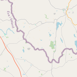
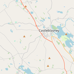
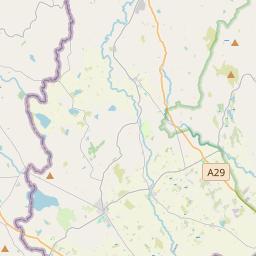
Leaflet | Map data © OpenStreetMap contributors
Area
Annayalla has an area of 19.1 km² / 4,717.2 acres / 7.4 square miles.
Townlands
There are 15 townlands that we know about in . This represents 100% of all the area in .
- Annaglogh 289 A, 1 R, 1 P
- Annayalla 363 A, 0 R, 37 P
- Cashel 552 A, 3 R, 0 P
- Coolartragh 332 A, 0 R, 20 P
- Cornahoe Upper 215 A, 2 R, 4 P
- Croaghan 508 A, 1 R, 28 P
- Drumgallan 187 A, 2 R, 34 P
- Glassdrumman East 176 A, 3 R, 24 P
- Latnakelly 140 A, 2 R, 9 P
- Lemgare 426 A, 3 R, 11 P
- Lisdrumgormly 256 A, 0 R, 33 P
- Lisnagreeve 197 A, 2 R, 33 P
- Tassan 499 A, 3 R, 6 P
- Tattyreagh North 311 A, 0 R, 27 P
- Tonagh 259 A, 0 R, 0 P
 OpenStreetMap
Annayalla was added to OpenStreetMap on 15 Feb 2017 by Teester.
- View
- Edit