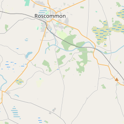
Based on data in OpenStreetMap, here is a list of townlands in the Electoral Division / ED / District Electoral Division of Drumdaff.
Drumdaff is in Co.
Drumdaff is not matched up to Logainm.ie yet.
Map
It is located at 53° 40' 13" N, 8° 6' 31" W.


Leaflet | Map data © OpenStreetMap contributors
Area
Drumdaff has an area of 20.8 km² / 5,147.4 acres / 8.0 square miles.
Townlands
There are 24 townlands that we know about in . This represents 100% of all the area in .
- Ballagh 184 A, 1 R, 21 P
- Ballinaboy 96 A, 3 R, 20 P
- Ballincurry 195 A, 2 R, 21 P
- Ballinwully 164 A, 2 R, 14 P
- Ballynacullia 125 A, 0 R, 25 P
- Carrowcrin 261 A, 0 R, 2 P
- Cartron 66 A, 2 R, 21 P
- Cartron (Brett) 70 A, 3 R, 19 P
- Cartron (Coote) 120 A, 0 R, 14 P
- Cloonageeragh 560 A, 1 R, 3 P
- Cloonarragh 510 A, 2 R, 13 P
- Clooncashel Beg 350 A, 1 R, 1 P
- Clooncashel More 275 A, 2 R, 24 P
- Cloonerk 182 A, 2 R, 20 P
- Corbo 372 A, 2 R, 38 P
- Corry 318 A, 0 R, 13 P
- Derryconny 66 A, 0 R, 3 P
- Drumdaff 276 A, 2 R, 29 P
- Emmoo 248 A, 0 R, 1 P
- Fearmore 50 A, 0 R, 33 P
- Gortyleane 107 A, 2 R, 9 P
- Keelcurragh 51 A, 2 R, 11 P
- Kilroosky 91 A, 0 R, 5 P
- Lisgobban 400 A, 3 R, 6 P
 OpenStreetMap
Drumdaff was added to OpenStreetMap on 24 Dec 2016 by Boggedy.
- View
- Edit

 JOSM
JOSM iD
iD