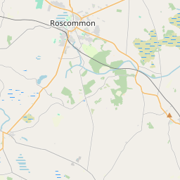
Based on data in OpenStreetMap, here is a list of townlands in the Electoral Division / ED / District Electoral Division of Kilgefin.
Kilgefin is in Co.
Kilgefin is not matched up to Logainm.ie yet.
Map
It is located at 53° 42' 10" N, 8° 5' 16" W.


Leaflet | Map data © OpenStreetMap contributors
Area
Kilgefin has an area of 21.3 km² / 5,259.5 acres / 8.2 square miles.
Townlands
There are 27 townlands that we know about in . This represents 100% of all the area in .
- Aghaclogher 198 A, 2 R, 29 P
- Aghalahard 150 A, 3 R, 36 P
- Aghamuck 196 A, 2 R, 29 P
- Aghawerriny 168 A, 1 R, 17 P
- Bogwood 201 A, 1 R, 19 P
- Cappagh 152 A, 3 R, 6 P
- Carroward 90 A, 3 R, 12 P
- Carrowmoneen 186 A, 0 R, 17 P
- Cartron 54 A, 2 R, 14 P
- Clooncah 567 A, 0 R, 6 P
- Cloonshee (Connor) 122 A, 2 R, 8 P
- Cloonshee (Hartland) 139 A, 3 R, 0 P
- Cooltacker 80 A, 2 R, 7 P
- Fairymount 676 A, 2 R, 7 P
- Killattimoriarty 306 A, 1 R, 23 P
- Killultagh 87 A, 3 R, 10 P
- Kilmacuagh 80 A, 0 R, 12 P
- Kilnalosset 117 A, 1 R, 13 P
- Kilnasillagh 107 A, 0 R, 39 P
- Knockavurrea 30 A, 2 R, 0 P
- Lackan 372 A, 1 R, 29 P
- New Glebe 17 A, 1 R, 22 P
- Reagh 160 A, 1 R, 27 P
- Sheehaun (Hughes) 17 A, 3 R, 32 P
- Sheehaun (Morton) 169 A, 3 R, 1 P
- Trilacroghan 325 A, 1 R, 4 P
- Tuam 480 A, 0 R, 5 P
 OpenStreetMap
Kilgefin was added to OpenStreetMap on 25 Dec 2016 by Boggedy.
- View
- Edit

 JOSM
JOSM iD
iD