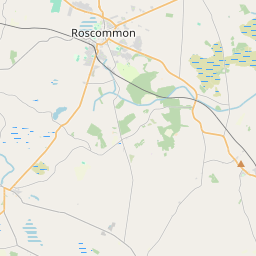
Based on data in OpenStreetMap, here is a list of townlands in the Electoral Division / ED / District Electoral Division of Roscommon Rural.
Roscommon Rural is in Co.
Roscommon Rural is not matched up to Logainm.ie yet.
Map
It is located at 53° 38' 0" N, 8° 11' 30" W.


Leaflet | Map data © OpenStreetMap contributors
Area
Roscommon Rural has an area of 46.4 km² / 11,468.8 acres / 17.9 square miles.
Townlands
There are 34 townlands that we know about in . This represents 100% of all the area in .
- Acres 144 A, 1 R, 29 P
- Ardkeel 422 A, 0 R, 21 P
- Ardnanagh 29 A, 3 R, 30 P
- Ardnanagh 126 A, 3 R, 23 P
- Ardsallagh Beg 182 A, 2 R, 34 P
- Ardsallagh More 268 A, 3 R, 31 P
- Ballinagard 406 A, 0 R, 0 P
- Ballindall 244 A, 0 R, 15 P
- Ballyboughan 260 A, 3 R, 14 P
- Ballybride 487 A, 0 R, 28 P
- Ballybride 1 A, 2 R, 3 P
- Ballygalda 597 A, 0 R, 39 P
- Ballymartin Beg 115 A, 1 R, 6 P
- Ballymartin More 247 A, 3 R, 7 P
- Ballypheasan 200 A, 0 R, 2 P
- Barnhill 180 A, 2 R, 19 P
- Bohergarve 152 A, 1 R, 24 P
- Carrowmore 585 A, 3 R, 26 P
- Carrownabricka 612 A, 2 R, 3 P
- Carrowroe 482 A, 3 R, 30 P
- Cloonbrackna 46 A, 3 R, 33 P
- Cloonbrackna 49 A, 0 R, 0 P
- Cloonybeirne 543 A, 2 R, 0 P
- Creevyquin 231 A, 0 R, 12 P
- Killarney 346 A, 1 R, 31 P
- Lisbride 256 A, 0 R, 8 P
- Lisnacroghy 222 A, 1 R, 4 P
- Lisnamult 299 A, 1 R, 35 P
- Loughanbane 181 A, 1 R, 5 P
- Mullymucks 1540 A, 1 R, 34 P
- Ranelagh 70 A, 3 R, 7 P
- Roxborough 1079 A, 3 R, 14 P
- Slevinagee 102 A, 2 R, 5 P
- Stonepark 749 A, 2 R, 18 P
 OpenStreetMap
Roscommon Rural was added to OpenStreetMap on 27 Dec 2016 by Boggedy.
- View
- Edit

 JOSM
JOSM iD
iD