Based on data in OpenStreetMap, here is a list of townlands in the Electoral Division / ED / District Electoral Division of Modeshil.
Modeshil is in Co.
Modeshil is not matched up to Logainm.ie yet.
Map
It is located at 52° 33' 49" N, 7° 29' 4" W.
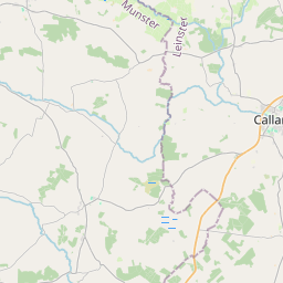


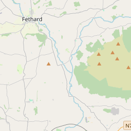
Leaflet | Map data © OpenStreetMap contributors
Area
Modeshil has an area of 24.7 km² / 6,097.9 acres / 9.5 square miles.
Townlands
There are 14 townlands that we know about in . This represents 100% of all the area in .
- Affoley 166 A, 0 R, 33 P
- Aughnacrumpane 106 A, 2 R, 5 P
- Ballintaggart 1283 A, 1 R, 24 P
- Cappagh 519 A, 1 R, 4 P
- Clashbeg 200 A, 3 R, 31 P
- Cloncurry 46 A, 3 R, 20 P
- Fanningsbog 111 A, 1 R, 2 P
- Harleypark 372 A, 2 R, 2 P
- Jessfield 389 A, 3 R, 14 P
- Knockulty 324 A, 1 R, 36 P
- Mackinawood 204 A, 0 R, 15 P
- Modeshil (Ayre) 1029 A, 0 R, 0 P
- Modeshil (Sankey) 379 A, 2 R, 38 P
- Mohober 963 A, 2 R, 30 P
 OpenStreetMap
Modeshil was added to OpenStreetMap on 9 Dec 2016 by Teester.
- View
- Edit