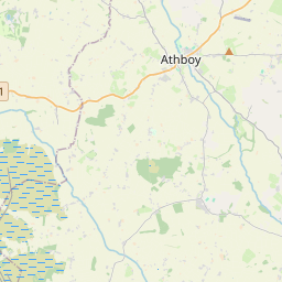
Based on data in OpenStreetMap, here is a list of townlands in Killua.
Killua is in the baronies of Delvin.
Killua is in the counties of Westmeath.
Killua is on Logainm.ie: Killua.
Map
It is located at 53° 38' 53" N, 6° 59' 50" W.


Leaflet | Map data © OpenStreetMap contributors
Area
Killua has an area of 21.3 km² / 5,261.8 acres / 8.2 square miles.
Townlands
There are 12 townlands that we know about in Killua. This represents 100% of all the area in Killua.
- Baile an Locha (see Ballinlough (Baile an Locha) , Killua Civil Parish, Barony of Delvin, Co. Westmeath)
- Ballinlough (Baile an Locha) , Killua Civil Parish, Barony of Delvin, Co. Westmeath 433 A, 1 R, 19 P
- Cill Dalua (see Killua (Cill Dalua) , Killua Civil Parish, Barony of Delvin, Co. Westmeath)
- Cill Rois Íochtarach (see Kilrush Lower (Cill Rois Íochtarach) , Killua Civil Parish, Barony of Delvin, Co. Westmeath)
- Cill Rois Uachtarach (see Kilrush Upper (Cill Rois Uachtarach) , Killua Civil Parish, Barony of Delvin, Co. Westmeath)
- An Cloichreán (see Cloran and Corcullentry (An Cloichreán) , Killua Civil Parish, Barony of Delvin, Co. Westmeath)
- Clonmellon (Ráistín) , Killua Civil Parish, Barony of Delvin, Co. Westmeath 342 A, 0 R, 8 P
- Cloran and Corcullentry (An Cloichreán) , Killua Civil Parish, Barony of Delvin, Co. Westmeath 900 A, 3 R, 10 P
- Corcullentry (see Cloran and Corcullentry (An Cloichreán) , Killua Civil Parish, Barony of Delvin, Co. Westmeath)
- Dervotstown, Killua Civil Parish, Barony of Delvin, Co. Westmeath 303 A, 2 R, 0 P
- Heathstown, Killua Civil Parish, Barony of Delvin, Co. Westmeath 491 A, 2 R, 14 P
- Killua (Cill Dalua) , Killua Civil Parish, Barony of Delvin, Co. Westmeath 955 A, 2 R, 30 P
- Kilrush Lower (Cill Rois Íochtarach) , Killua Civil Parish, Barony of Delvin, Co. Westmeath 451 A, 3 R, 23 P
- Kilrush Upper (Cill Rois Uachtarach) , Killua Civil Parish, Barony of Delvin, Co. Westmeath 454 A, 0 R, 3 P
- Knock Killua, Killua Civil Parish, Barony of Delvin, Co. Westmeath 303 A, 2 R, 15 P
- Lower Kilrush (see Kilrush Lower (Cill Rois Íochtarach) , Killua Civil Parish, Barony of Delvin, Co. Westmeath)
- Lower Moygrehan (see Moygrehan Lower, Killua Civil Parish, Barony of Delvin, Co. Westmeath)
- Moygrehan Lower, Killua Civil Parish, Barony of Delvin, Co. Westmeath 259 A, 2 R, 39 P
- Moygrehan Upper, Killua Civil Parish, Barony of Delvin, Co. Westmeath 238 A, 2 R, 21 P
- Paristown, Killua Civil Parish, Barony of Delvin, Co. Westmeath 126 A, 3 R, 14 P
- Ráistín (see Clonmellon (Ráistín) , Killua Civil Parish, Barony of Delvin, Co. Westmeath)
- Upper Kilrush (see Kilrush Upper (Cill Rois Uachtarach) , Killua Civil Parish, Barony of Delvin, Co. Westmeath)
- Upper Moygrehan (see Moygrehan Upper, Killua Civil Parish, Barony of Delvin, Co. Westmeath)
 OpenStreetMap
Killua was added to OpenStreetMap on 24 Nov 2014 by brianboru.
- View
- Edit

 JOSM
JOSM iD
iD