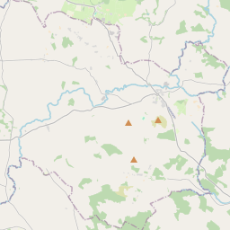
Based on data in OpenStreetMap, here is a list of townlands in the Electoral Division / ED / District Electoral Division of Imael North.
Imael North is in Co.
Imael North is not matched up to Logainm.ie yet.
Map
It is located at 52° 59' 46" N, 6° 31' 47" W.


Leaflet | Map data © OpenStreetMap contributors
Area
Imael North has an area of 48.8 km² / 12,059.9 acres / 18.8 square miles.
Townlands
There are 36 townlands that we know about in . This represents 100% of all the area in .
- Ballinard 326 A, 2 R, 19 P
- Ballinclea 310 A, 1 R, 30 P
- Ballyvoghan 246 A, 1 R, 31 P
- Ballyvraghan 183 A, 1 R, 30 P
- Blackpits 314 A, 3 R, 11 P
- Blane 268 A, 1 R, 37 P
- Brittas 412 A, 1 R, 12 P
- Bushfield 152 A, 0 R, 23 P
- Camara 216 A, 3 R, 3 P
- Camarahill North 261 A, 3 R, 18 P
- Camarahill South 228 A, 2 R, 17 P
- Cannow 319 A, 0 R, 23 P
- Cannow Mountain 1135 A, 1 R, 35 P
- Clornagh 118 A, 1 R, 30 P
- Coan 377 A, 3 R, 15 P
- Colliga 338 A, 0 R, 39 P
- Crissadaun 314 A, 0 R, 6 P
- Drumreagh 148 A, 1 R, 8 P
- Knickeen 121 A, 2 R, 4 P
- Knockanarrigan 254 A, 1 R, 22 P
- Knockandarragh 378 A, 2 R, 1 P
- Knocknamunnion 321 A, 0 R, 39 P
- Leitrim 358 A, 1 R, 14 P
- Leoh 1009 A, 2 R, 36 P
- Levern 215 A, 0 R, 7 P
- Lobawn 411 A, 3 R, 14 P
- Lugnaquillia 874 A, 2 R, 32 P
- Monroe 93 A, 0 R, 25 P
- Moorspark 85 A, 1 R, 24 P
- Newpark 212 A, 1 R, 31 P
- Pollaghdoo 476 A, 1 R, 38 P
- Seskin 256 A, 1 R, 10 P
- Snugborough 272 A, 0 R, 7 P
- Stranahely 373 A, 0 R, 12 P
- Sugarloaf 160 A, 0 R, 38 P
- Table Mountain 511 A, 3 R, 20 P
 OpenStreetMap
Imael North was added to OpenStreetMap on 1 Oct 2016 by Teester.
- View
- Edit

 JOSM
JOSM iD
iD